
Tour the Loops
From the Summer 2023 Issue
For motorists with a yen for adventure—and the right vehicle—two loops offer back road discoveries
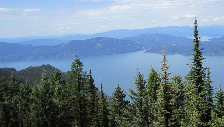
VIEW TAKEN FROM ATOP SHAFFER PEAK. PHOTO BY PAMELA LARSON.
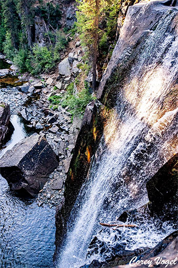
CHAR FALLS. PHOTO BY COREY VOGEL.
If you wish to explore the east side of Bonner County, a number of looping, expeditionary routes begin at one of two landmark gas stations in Clark Fork, 25 miles east of Sandpoint on Highway 200. Turn north at the Chevron and follow Lightning Creek Road 419 to Trestle Creek Road 275 and exit ten miles west of Clark Fork on Highway 200. The trip is approximately 35 miles.
Or turn south past the Cenex, cross the Clark Fork River, and enter a world where roads run every which way. Depending on intent and navigational skills, you might come out at Bayview, Silverwood, or Kingston, Idaho; or you can even find yourself in Thompson Falls, Trout Creek or Noxon, Montana. The Clark Fork to Silverwood route, encompassing the aptly-named “High Drive,” is approximately 50 miles, depending.
Some pro tips: 1.) Fuel up. 2.) Leave the Prius and bring the SUV. 3.) Assure your spare is good. 4.) A free current Forest Service Motor Vehicle Use Map will save time, trouble and panic attacks. Google Maps won’t. (You can pick one up at any ranger station, or download one here: www.sptmag.com/fsmotormap)
Disclaimers made, there are many things to do along these routes, depending on your energy level and the time you have to invest, of which you might bring plenty. There are myriad opportunities for camping, hiking, fishing, huckleberry hunting, peak bagging, swimming, and plain old car-based sightseeing.
THE NORTHERN ROUTE
Beyond the private land signs on Road 419 are many semi-private campsites near the stream. An SUV can get to most, but use caution. Walk in first. Pitching a tent near a creek is therapeutic. Getting stuck is not. Be bear aware. Keep a clean camp and release any bull trout caught.
Many trails begin on this loop. A sampling: Goat Mountain Trail is four miles north of Clark Fork. At Mile 7.5, turn right to East Fork Creek trailhead and hike to Lightning or East Fork Peak. At Mile 9.5 ±, a motorized trail to Porcupine Lake goes to the west, but Lightning Creek has to be forded. At Mile 17, 40-foot Char Falls is on the right, and well worth a visit. At Mile 18, 419 intersects Trestle Creek Road 275, the route back to Highway 200. Beyond 275 are trails to Lake Darling and Moose Lake. Both are easy hikes to lovely destinations. If you wish to sweat, Trail 52 past Lake Darling climbs to Trail 67 and Pend Oreille Peak, with dazzling views of the Selkirks, Purcell Trench and the West Cabinets.
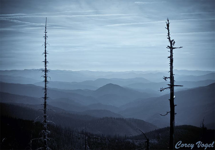
SEEMINGLY ENDLESS VIEW OF THE COEUR D’ALENE MOUNTAINS VISIBLE JUST OFF OF 332/430-1 ON THE HIGH DRIVE. PHOTO BY COREY VOGEL.
Road 275 climbs to the divide between Trestle and Lightning, where Trail 120 begins and runs south for several spectacular miles to a trailhead at the end of West Spring Creek Road. Just beyond Trail 120, Road 1091 turns north to Lunch Peak and a USFS rental lookout. Trail 67 begins here and follows the divide north to Calder Mountain and other trails that lead clear to the Kootenai River.
About 1.5 miles downhill from 1091, Trail 56 leads west to Trail 526 which leads to Trout Peak. Then, Road 275 continues in a long drop back to Highway 200.
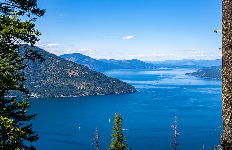
THIS HIGH DRIVE VIEW OF LAKE PEND OREILLE WAS TAKEN FROM BERNARD OVERLOOK ON 2707, WHICH IS AN OFFSHOOT ABOVE THE LAKE OF THE BUNCO/HIGH DRIVE MAIN ROAD. PHOTO BY COREY VOGEL.
THE SOUTHERN ROUTE(S)
Decisions, decisions. If you choose the southern route(s), turn right at the end of the river bridge to Johnson Creek and Road 278, the mother road east of Lake Pend Oreille. On its rise to Monarch Ridge, 278 passes Road 2710, leading to Johnson Point Vista, where the lake can be seen from 1,500 feet above. Beyond where 278 crests, Road 1066 goes left to an intersection with Roads 306 and 332. Road 306 drops into the North Fork of the Coeur d’Alene River, eventually leading to Interstate 90 at Kingston. Eventually.
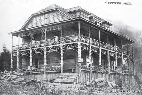
THE ODDLY NAMED “HOTEL SWASTIKA,” OPERATED BY THE SWASTIKA MINING COMPANY. IT CLOSED AND LATER BURNED IN 1930. COURTESY SPOKANE HISTORICAL SOCIETY
Road 332, AKA “The High Drive,” goes southeast toward Buckskin Saddle, Delyle Ridge, and routes back to Clark Fork via Twin Creek (Road 1031) and Dry Creek (Road 2038). It also leads the other way, southwest along the Monarch Divide, roughly parallel to 278 and several thousand feet above. Many trails, motorized and not, connect the two, including one that tops out on Packsaddle Mountain, the westernmost high point of the Coeur d’ Alene Range.
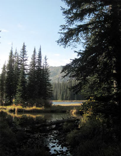
LAKE DARLING. PHOTO BY SANDY COMPTON.
The High Drive is huckleberry heaven. On warm August days, the smell of ripe berries leads pickers to patches. It is also rife with dispersed camp sites, but water is scarce on the ridge, so bring plenty.
From its intersection with 1006, 278 falls down Granite Creek to follow the lake shore past Whiskey Rock Campground and Cedar Creek community to Lakeview, a ghost-ish town with mining roots at Gold Creek. After Lakeview, Road 278 meanders through a labyrinth of routes back to high ground, so watch the map. For another grand view of the lake, take Road 2707 to the Bernard Overlook. Road 2707 merges again with 278, which finally joins with 332, which leads to Bunco Road and US 95 at Silverwood.
You can find your way home from there. Admittedly, this is a bare bones primer, with missing details. That’s part of the fun of exploration—and that’s what the map’s for, right?

I was born in Sandpoint. We might try this while we are there next week.